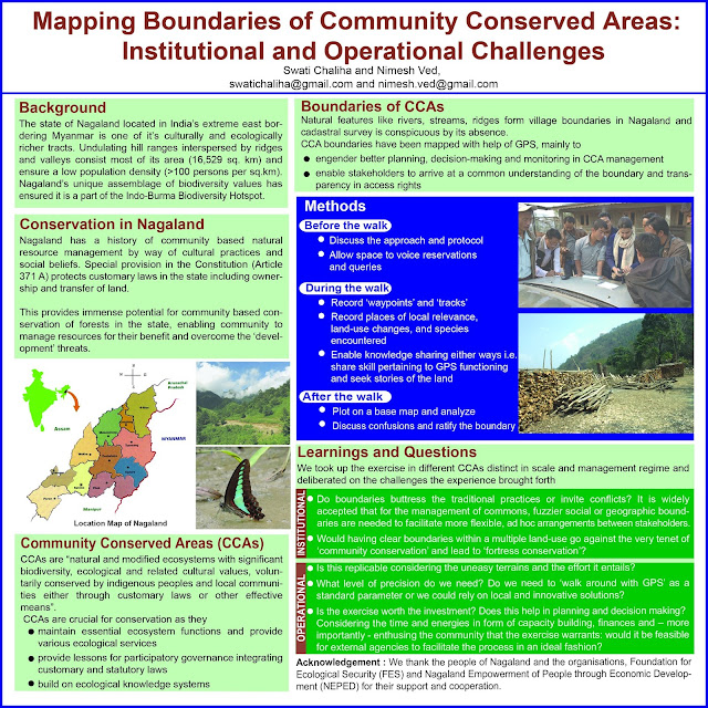
Mapping boundaries of Community Conserved Areas: Institutional and operational challenges
Pleased
to share a poster presented at IUFRO 2014 World
Congress
Congress Theme: Forests for People
Title: Mapping boundaries of Community Conserved Areas: Institutional and operational
challenges
Authors: Swati Chaliha and Nimesh Ved
Abstract:
Defining
spatial boundaries of Community Conserved Areas (CCA) are perceived as
pertinent for stakeholders to have common understanding and for laying down
operational rules. In Nagaland, India assigning natural features as boundaries
have been a customary practice and cadastral maps do not exist. Having CCA
boundaries here is crucial in the wake of current development and conservation
paradigm. Process of mapping boundary led to myriad questions. While in one CCA
of Nagaland, authors with villager’s support mapped boundary by walking with
GPS receivers, and data analysed using GIS; in another CCA efforts involved
equipping selected villagers with skills of using GPS for mapping. In the first
case, an organized arrangement between traditional governing setup and
institution managing CCA aided mapping process. In the second case, terrain was
difficult and synchronization between different governing institutions was
weak. Questions arose whether it is worth the effort and could notional
boundaries solve the purpose. Villagers’ confusions ranged from whether they
would lose land to if boundary could be amended at a later stage. These CCAs,
differing in context, geography and institutional arrangements helped
understand that multiple participatory approaches for mapping could be
effective and aid management decisions of different nature in the CCAs.
Acknowledgement:
NEPED, Everyone at Nagaland we interacted with in course of the visits - especially both the CCAs, FES, colleagues at Guwahati office and IUFRO.
Related
posts:

Comments
Post a Comment